
Your crews collect it. We draft it.
Field data piling up in the office? We turn your points, notes and sketches into finished survey drawings, drafted to your standards, so your party chiefs stay in the field and your RPLS spends time reviewing, not drafting.
Fieldwork finishes. The drawings don’t.
Jobs sit waiting for drafting long after the crew has left the site.
Party chiefs end up drafting instead of collecting billable data.
Experienced survey drafters are scarce and expensive to keep.
Drafted in your layers, linetypes and title block.
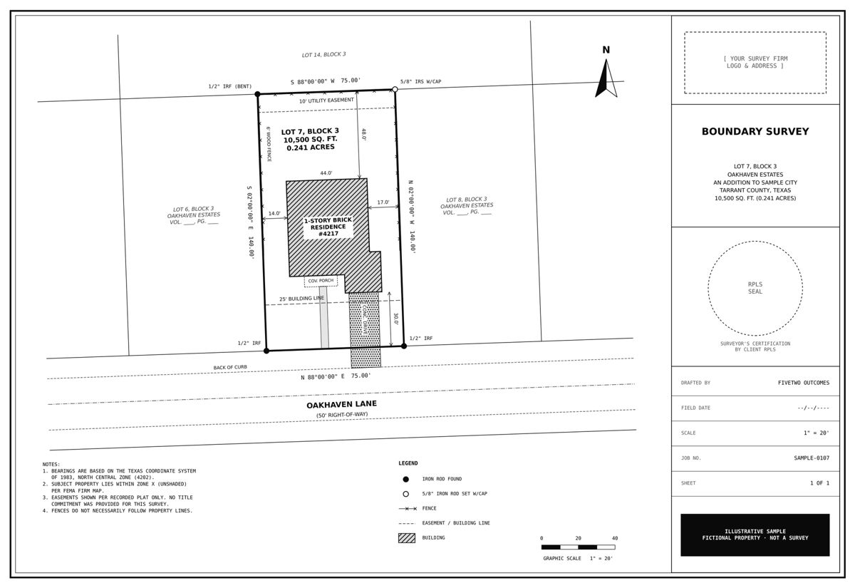
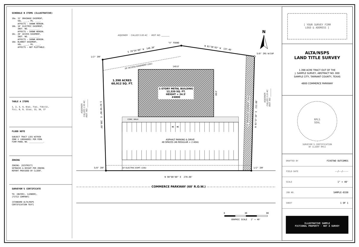
Boundary & ALTA/NSPS surveys
Residential boundary surveys and ALTA/NSPS land title surveys drafted from your field data, calcs and title commitment, with Schedule B items plotted.
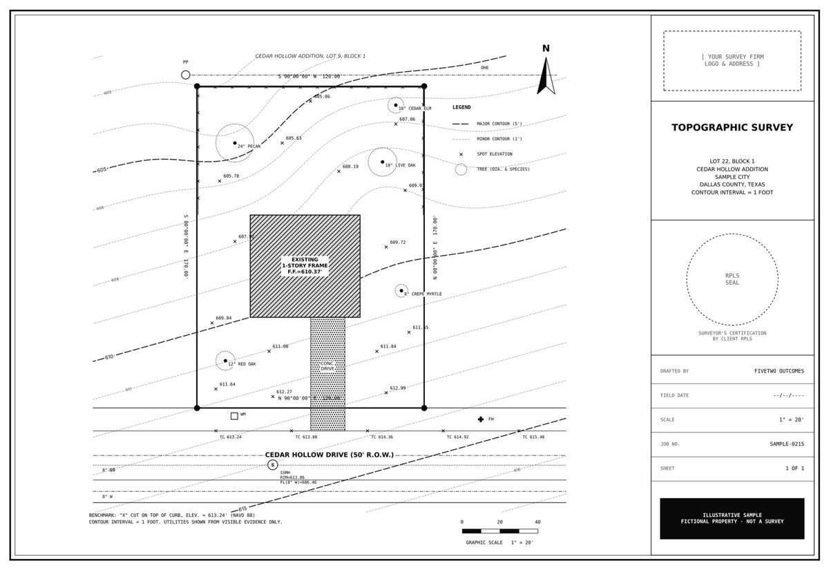
Topographic surveys
Existing conditions, contours and spot elevations, including TIN surfaces in Civil 3D.
Plats & replats
Subdivision plats and replats drafted to City and County platting requirements.
Easement & exhibit drawings
Easement exhibits, metes-and-bounds sketches and right-of-way exhibits.
Field-to-finish cleanup
Point and linework cleanup, labeling and sheet setup so drawings come out consistent.
Quick-turn revisions
Redlines turned around fast with a changelog, so you know exactly what changed.
Upload the job. Get drawings back.
Everything starts with a mutual NDA and a secure project folder. You see exactly what changed on every revision.
Sample survey drawings
Illustrative samples of the deliverables we draft. Properties shown are fictional.
Questions survey companies ask us
FiveTwo Outcomes provides outsourced survey drafting for land surveying companies in Texas. We turn field data into finished boundary surveys, topographic surveys, plats and exhibits, drafted to each firm’s CAD standards and ready for the RPLS to review and seal.
What is outsourced survey drafting?
Your field crews collect the data, and we draft the finished drawings in your office’s CAD template. Your RPLS reviews and seals them, so your crews stay in the field and your office backlog clears faster.
What survey drawings do you draft?
Residential boundary surveys, ALTA/NSPS land title surveys, topographic surveys and existing-conditions surfaces, subdivision plats and replats, easement and right-of-way exhibits, and field-to-finish linework cleanup.
Do you work in our CAD template and standards?
Yes. We draft in your layers, linetypes, text styles and title block, using AutoCAD, Civil 3D or MicroStation.
How do we send field data?
After a mutual NDA, we set up a secure project folder. You upload points, field notes, sketches and your template, and we deliver drawings back to the same folder with a revision history.
Who signs and seals the survey?
Your Registered Professional Land Surveyor (RPLS) reviews, redlines and seals the work. We prepare the drawings and make the revisions.